
June 27th - 2022 is turning out to be a dry year but low rainfall is only one part of the equation..
- Mark Hunt

- Jun 27, 2022
- 10 min read

Hi All,
Back from a lovely week in timeless North Norfolk and fortunately the weather played ball. Not for fishing though because the water clarity was really poor from Cley eastwards. Locals blamed algae blooms, excessive Mayweed (a type of seaweed) and Anglian Water's habit of dumping of raw sewerage into the sea during periods of heavy rainfall.
On the plus side it was great to watch Marsh Harriers and Avocets in close proximity and there were loads of butterflies about. I was surprised one evening to see Cley Beach inundated with swarming Chafer Beetles, I didn't think it was the right habitat but timing-wise, the 3rd week of June is about right I guess.....It soon cleared the beach of swimmers and sunbathers 🤣 !
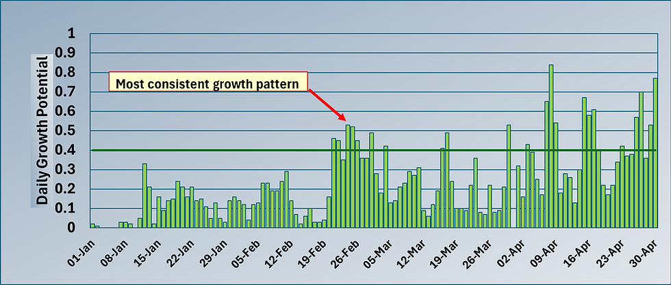
As mentioned in the title, 2022 so far (famous last words) is turning out to be a pretty dry year not only because of less than usual rainfall but also higher E.T. I'll be having a look at some stats later in the blog but some areas have only received 50% of their rainfall vs. 2021.

General Weather Situation
So as we start this week you can see from the GFS out that we have an Atlantic low pushing in cooler and unsettled weather from the west leading to an east-west divide in terms of temperature and rainfall this week.
So Monday sees a band of rainfall pushing across west to east and bringing a bit of a relief in terms of cooler temperatures, lower E.T and a bit of rain as it does so.
As I look on Netweather.tv's rain radar, there's some pretty heavy showers moving along the south coast and across northern England and the arrival of more showers to Ireland's western coast. On the cool side then for the end of June with temperatures in the 15-18°C range and with a blustery south westerly wind in situ. Later in the day more substantial rain arrives for Ireland and pushes slowly eastwards overnight into Tuesday.
Tuesday see's this next band of rain vector north and east into north west England, The Lakes and the south west of Scotland from the off, with the main body of this rain still sitting across Ireland. Away from this rain front, southern and central areas will have a dry start to the day with plenty of sunshine and pleasant temperatures. Through the course of the day, the rain will clear the east of Ireland and push into the north west of England and south west of Scotland. By late afternoon, the southern end of this rain band will make landfall across The South West and West Wales and then push eastwards. Depending on rainfall and cloud cover expect 15-17°C in the west and north west / Scotland vs. 20-21°C in the drier south and east.
Overnight into Wednesday and that rain front is slowly moving eastwards across central areas leaving Scotland and Ireland, on the dull, cool side with some showers as a legacy. Through the course of the morning this front will break down into showers across central areas and more rain will arrive into the west of Ireland and south west of England. This rain will also affect Wales and the north west of England during the afternoon but isn't projected to move into central areas during daylight. Temperatures similar to earlier in the week and still with that moderate to blustery south westerly / southerly wind.
Onto Thursday and dawn sees rain across the east of Ireland, north west of England and most of Scotland. During the morning this rain moves eastwards slowly into Wales and northern England but away from this, it'll remain dry and warm, so a real west-east split. That rain across the east and north east of Ireland will be slow to clear and will hang around into the afternoon and only slowly edge northwards. Southern and central areas of England will have a pretty nice day with temperatures into the low twenties and some showers threatening later in the afternoon.
Closing out the week on Friday and we will see a continuation of showers across the north west of England, west of Scotland, but drier and brighter further south and east. Ireland starts reasonably dry but more rain pushes into Kerry by lunchtime and then moves north and east. Across The Irish Sea we may see some showers push inland but most of the westerly rain fizzles out during Friday afternoon to leave plenty of sunshine and pleasant temperatures.
The outlook for the weekend is wet on Saturday for Ireland, The South West and Wales initially before the rain moves north and east into the north west of England and Scotland. During Saturday afternoon, that rain will push into the north east of England. Drier and brighter south and east as has been the pattern all week. Sunday looks the better day as high pressure begins to assert itself, but there's still rain on the radar for the south east of Ireland, north west of England and west of Scotland. We may see more rain consolidate over Scotland during the day and this will push down into The Borders. Some better temperatures around especially for Wales and The South West which should be on a par with the south and east of England at 21-22°C. Further north and west expect high teens.

Weather Outlook
Now here's the GFS projection for a weeks time, the 4th of July. It is interesting because you can see a patch of purple over northern Africa and this denotes intense heat. Followers of my previous blog will know that last year was the first time I'd seen this purple colour on a GFS map, but here it is again. It is my belief that at some point we will see a heat plume push this type of heat across the U.K & Ireland and in so doing we will register our first 40°C+ temperatures. With this type of heat appearing at the beginning of July are we odds on for a new heatwave ?
Well not just yet but I do think next week looks to see a return of warmer temperatures and settled weather. Nothing too extreme temperature-wise, I think low twenties is in order and with light winds, initially northerly but decreasing as we progress through the week. High pressure looks to be in charge to me. Trying to look beyond that is a real Mystic Meg job but if I played to my hunch I'd say that more unsettled weather will arrive the week after. We will see. Looks like Ireland will share in this nice weather as well for a change whereas Scotland will sit a little cooler and unsettled the further north you go.
10-Day weather GIF's for pressure, temperature and rainfall courtesy of Tropicaltidbits.com


Agronomic notes
While I was away we saw a real night and day weather event with the very transient heat plume on the 16th of June, followed by a cool temperature trough the day after. It was typical of our island climate to see such extremes in temperature and E.T within a 24-hour period.
To use the word 'extreme' to describe weather events is common place now and I know there's a section of society that holds a position that what we see is not extremes, it's all happened before in the past and we just 'media-ise' it to death nowadays. I think there's an element of truth about this viewpoint and for sure there's nothing the Daily Tabloids like better than to hype our weather. What we saw on the 16th and 17th of June was extremes though because on one site I monitor, the daily E.T total hit 7.43 mm, the highest I've ever seen. At the same time / date, we reached 31.4°C at that site (not a record) but then the next day, the temperature didn't get above 21°C and the E.T dropped to 2.73 mm. In some areas there was a 17°C temperature drop, now that's extreme.
Here's how the E.T shaped up over that period ;

Quite some difference I'm sure you'll agree !
7.43 mm moisture loss in a 24-hour period equates to 75,000L across a hectare and would mean you'd need to apply 60% of that just to keep turf healthy. That's a lot of water.
Take Rutland Water, it covers 1,200 hectares so by my calculations it would have lost 19,682,113 gallons of water on that day due to E.T, sorry for the change in units. Now I'm sure it would actually be less than this because of the dynamics of temperature over water vs. land, but it still would have been a heck of a lot of water evaporated in a day.
So are we in a drought period, is 2022 a drier year or one characterised by more moisture loss by evapotranspiration ?
Well a bit of both I think and of course in this statement we have geographical variability. The north and west has seen more rain and less E.T but I can only comment on the sites where I can compare data year-on-year.
Here's a quick snapshot showing rainfall and E.T data (where available) for the first 6 months of last year vs. 01-01-22 - 27-06-22
Location - Sevenoaks Rainfall y.t.d 06-21 E.T y.t.d 06-21 Surplus or deficit
447.8 mm 276.6 mm 171.2 mm
Rainfall y.t.d 06-22* E.T y.t.d 06-22* Surplus or deficit
* = Up until 27-06-22 223 mm 308.1 mm - 85.1 mm
In this location you can see that the rainfall up until 27-06-22 is just shy of 50% of the previous year and the E.T is 11% higher so between the two, they have resulted in a moisture deficit y.t.d in 2022 vs. a moisture surplus in 2021 over practically the same time interval. So we shouldn't just focus on rainfall amounts when we look at how wet or dry it is, we also need to factor in E.T.
Here's the same stats from our default location at The Oxfordshire, Thame ;
Location -Thame Rainfall y.t.d 06-21 E.T y.t.d 06-21 Surplus or deficit
378 mm 331.44 mm 46.55 mm
Rainfall y.t.d 06-22* E.T y.t.d 06-22* Surplus or deficit
* = Up until 27-06-22 243.8 mm 365.96 mm - 122.16 mm
So again here we see the same pattern, a 36% reduction in rainfall y.t.d '22 and a 10% increase in E.T.
And here for Northampton ;
Location -Northampton Rainfall y.t.d 06-21 E.T y.t.d 06-21 Surplus or deficit
356.6 mm 316.85 mm 39.75 mm
Rainfall y.t.d 06-22* E.T y.t.d 06-22* Surplus or deficit
* = Up until 27-06-22 287.6 mm 335.89 mm - 48.29 mm
Again the same pattern, a 20% reduction in rainfall y.t.d and a 6% increase in E.T.
Across Wales we have seen a 37% reduction in rainfall at Harlech and a 35% reduction at Swansea. However I can comfortably assert this will not stay this way as I'm due to take the camper to Rhossili and Pwllheli this summer / autumn 😂
So yes to summarise we are drier than usual but also we have lost more moisture by E.T in '22 vs. '21 and you need to factor in both when describing a drought scenario. Of course we don't because when did you ever hear a weather forecaster mention E.T ???

Anthracnose Trigger
Back in May across the south of the U.K, we saw some pretty hot temperatures followed by rainfall (and high humidity). In Scotland they had a warm beginning to June and obviously we had a very warm middle of the month, followed again by rainfall as the high pressure system broke down.
I've looked at the data and to me for the southern half of the U.K, it suggests that the May data ran very close to an Anthracnose trigger and the June's data was 100% full on definitive. Add to that the plethora of high E.T days that would have imparted stress on the grass plant. For info, I use +4mm as a guide for Poa annua but obviously this depends on a number of variables not least the efficacy of your irrigation system (coverage), organic matter levels, sward composition, etc. To recap what we are looking at / for is consecutive days of high temperature > 25°C followed by moisture / high humidity to allow the fungus to develop and penetrate the leaf of the host plant.
Thereafter the pathogen appears to sit in a resting state (Biotrophic) before plant stress triggers it and it becomes necrotrophic (leading to plant cell death).
Now there has to be some caveats here. Firstly, the fungal spores must start germinating at less than / close to 25°C and then the % increases as we exceed this threshold value. Secondly, if you just work on air temperature, it is a tad misleading because the spores sit in organic matter and we know O.M heats up more than air, so typically you might have a maximum air temperature of 23°C, but the O.M in your surfaces is heating up to and exceeding 25°C. That's why I think you still see outbreaks when we haven't reached the magical 25°C air temperature figure.
Let's put some data on this ;
May 2022 stats - Davis Vantage Pro Groweather with ISS - Sevenoaks, Kent

So you can see on the 16th - 19th of May, we ran some high air temperatures and this was then followed by high humidity (at night) and rainfall. We also had some +4 mm E.T chucked in to boot.....
June 2022 stats - Davis Vantage Pro Groweather with ISS - Sevenoaks, Kent

Again we see the same pattern, in fact we had two periods of the month with consecutively high air temperature followed by rain, high humidity at night (wet leaf) and some very high daily E.T days greater than 4 mm.
For Scotland, the data isn't as strong, but it's close....

Ok we don't exceed that critical 25°C, but we are close and we have the necessary conditions thereafter with a wet leaf and humidity.
So for me as I said back in May, we should expect Anthracnose in the southern half of the U.K during June and looking at the June weather stats, the pressure will continue into July. Scotland may well see some appearing in July as well, dependent on local conditions.
Now before we hit our collective heads on the desk in the wake of another agronomic challenge to throw into the basket, the good news is that Anthracnose can largely be prevented by good IPM practices. In short what you don't want is a weak Poa plant, whether that be drought stress (which equates to nutrient deficiency in the plant) and / or low plant leaf nitrogen and potassium. Cutting height is also key as is rolling rather than cutting. Rutgers University have done a lot of work on this disease as it stands only below Dollar Spot in the league table of unwanted turf maladies U.S-style, so rather than me parrot fashion them, read it here
Most of it is just good cultural practices with a bit of common sense thrown in but since the latter appears to be in an all time short supply situation, it is worth reiterating.
Right, my head is addled, so until next week, enjoy and all the best...
Mark Hunt


Comments