
November 10th, 2025
- Mark Hunt

- Nov 10, 2025
- 7 min read
Hi All,
Well, our topsy-turvy weather continues into November with 18°C showing on my car thermometer as I drove towards the All England Lawn Tennis Club to attend their excellent two-day, Lawn Tennis seminar early last week.

Congratulations to Neil, Beth, Alex, Will and John (and anyone else I have forgotten) for making it a great event with an excellent insight into lawn tennis, great speakers and content (with the exception of me of course) and great hospitality. As always it was good to meet up with industry colleagues as well. One of the areas I covered in my talk at AELTC was current levels of PAR (Photosynthetically active radiation), the part of the light spectrum that the grass plant absorbs and how it affected grass growth. I'll discuss this later in the blog. As you can see above, Wimbledon are making extensive use of lighting rigs to compensate for our yearly dip in plant-available light.

Walking through Fineshade's Wood near Corby at the weekend, I mused whether the requirement for only a T-Shirt in early November is the new norm ?
I won't complain because it was great to feel the warmth from the sun but at the same time, it was a little unnatural. Part of the reason for this balmy / barmy weather is a southerly airstream pulling up mild air from southern Europe. Normally by now, we would have had a dose of easterly or northerly winds to remind us that winter is around the corner. Well looking to the forecast, is there any sign of a change to more 'normal' conditions for this time of year ?


General Weather Situation
Now, normally I would turn towards the GFS (Global forecasting system) projections for the coming week and beyond, but with the lack of research and resource now allocated to the U.S climate and weather services, courtesy of that large, orange individual in charge of the U.S, I will be taking a break from it and utilising the ECMWF (European centre for medium range weather forecasting) model for the future. In brief there are 2 longer-term weather models, the GFS and ECMWF. They do differ markedly in their output and I have always favoured the former, but let's see how the European model does.
So we start this week with an Atlantic low pressure firmly anchored off the west of Ireland and this system will dictate our weather for the first half of the week. As we would expect with a low pressure, it will usher in a mild, south westerly airstream with strong winds and rain over the course of Monday to Wednesday inclusive. That low pressure system will not move across the U.K & Ireland because it'll butt up against high pressure on the continent, so it'll sink down into The Bay of Biscay, maybe to return again. So wet, mild and windy is the outlook for the first half of the week with significant rain pushing across the U.K & Ireland moving across The North Sea to primarily affect Jylland, Denmark. Some rain will push further east across Denmark to affect Fyn and Sjaelland. Now as we get to the second part of the week that low pressure stalls, sinks lower and then drags wind off its leading edge. Spinning anti-clockwise, this means we will see a change in the wind direction at the end of the week from south westerly to north east / easterly. Since the wind is originating from the now southerly low pressure, it will continue to pull rain across the U.K, but it will be more orientated towards the southern half.
By the weekend, high pressure has pushed into the gap made by the sinking low pressure and that'll tidy up the weather a little and settle things down. So cooler and drier at the weekend, with a north easterly wind and most likely dull I'd say as cloud is scooped up off The North Sea. I think this slightly drier and cooler hiatus with last through the 1st part of next week before another deep Atlantic low pressure pitches up off the west of Ireland to bring more strong winds, rain and milder conditions.

Agronomic Notes
I have borrowed a slide from the presentation I gave last week to explain PAR and DLI and highlight where we are currently with plant-available light.
It explains which part of the light spectrum, the plant utilises and how this is then calculated into a 24-hour parameter known as the DLI - Daily Light Interval.
Focussing on Perennial ryegrass, we have an arbitrary figure that this species requires a minimum of 11 mols per m2 of PAR light for growth and presumably a higher figure for healthy growth. Now we must attach caution to this figure because it came from the U.S.A and from my limited knowledge of grass cultivars, there is a significant difference between European and U.S Lolium perenne cultivars, with the latter tending (IMHO) to be possess a more blue-green colouration with a wider leaf vs. the lighter colour, finer-leaved cultivars from European breeding.
It is a starting point, so if we take 11 mols per m2 as a lower benchmark for this species, we can then look at how much PAR light we are currently receiving on a day-to-day basis.

Looking at the above graph you can see how dull October 2025 was because most of the days provided insufficient light for Lolium perenne (less than 11 mols per m2 as shown on graph by horizontal line) and actually pretty much every other grass species, except Poa annua. There were actually 5 days out of the 31 total for October which came in > 11 mols per m2. For November, it is 3 out of 10 so far. (since it is heading to a 20mm rain day today I am banking on it being < 11 mols per m2)
So, we have a scenario where we have low light levels for sufficient growth of a grass plant species BUT at the same time we have those warm, mild air temperatures occurring later and later in the year.
I have graphed below the series for October and November to date where we look at the daily growth potential (green column) vs. the DLI (black line). I have then highlighted in red the days when the growth potential > 0.4, so that's high enough for good growth levels at this time of year AND the DLI was <11.0 mols per m2, the minimum sufficiency range of light for Lolium perenne.

So you can see there's a good number of days (coloured in red) when there was insufficient PAR light for growth BUT at the same time high enough air temperature to facilitate growth in terms of a ''good' Growth Potential.
So what wins, which factor dictates how the grass plant responds ?
Well, my hunch and this may be confirmed by those of you who record clipping yields for golf greens in the shade and open light, is that temperature is the top trump card and pushes the plant to grow. That growth though isn't 'normal' because the light level is insufficient, so the plant extends upwards by elongating to try and 'access' a higher light level. We have all seen this when we grow a plant in a place with insufficient light, it extends / elongates and becomes 'leggy'. So we get more upright growth, rather than tillering / lateral growth.
It doesn't just end there because there is a price to pay for that elongated growth habit. The cell walls become thinner and that confers an additional number of handicaps. The first being a plant that is more susceptible to wear / foot traffic and secondly, it is more susceptible to disease (thinner cells walls mean it is easier for a fungal mycelium to penetrate the surface of the leaf). At the same time if we have applied a fertiliser, we are effectively driving this process of elongated growth, pushing the grass plant to use its carbohydrate reserves to facilitate this growth, which we know at low light levels it can't replace via photosynthesis.
This low level of light that we have experienced of late is not out of the ordinary.
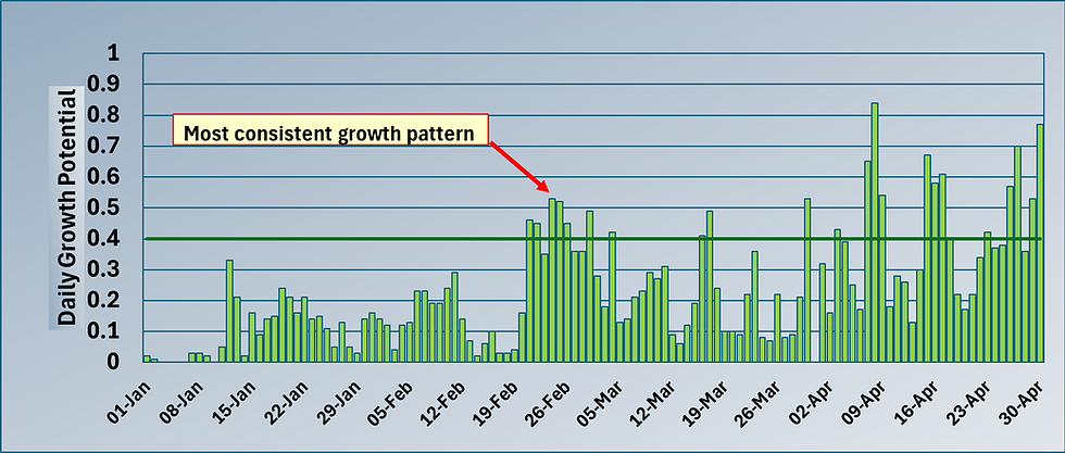
Looking at the DLI through a calendar year, we often see a marked dip in October as days shorten (shorter days = shorter duration of PAR light = lower DLI), it's a yearly fixture. We don't get back to decent DLI levels until March / April (typically early April consistently)
We also have a more frequent temperature scenario nowadays, with warmer air occurring later and later into the year. As a background effect, we may also have a higher potential for cloud formation (maybe) as the atmosphere warms it has the potential to hold more water vapour (For every 1°C rise in air temperature, the atmosphere can hold 7% more moisture).
So less light vs. warmer air temperature vs. (maybe) a fertility input....
Where this discussion is going is a notion that (maybe?) we should be adapting our approach to turf management knowing that we experiencing a changing climatic dynamic probably most markedly at this time of year. Perhaps it makes a case for lower nitrogen nutrition and / or extending the period of PGR usage later and later into the calendar year to counteract that elongated, upward growth habit.
Let's face it, regardless of whether you believe the theory behind it or not, there is a strong case for our climate warming. Just look at the graph above, you can see how the most recent years all feature in the highest mean temperature recorded (since 1884). Coincidence I don't think so.

Mean air temperature is only one parameter, we know there are also changes in rainfall patterns, atmospheric CO2 levels, etc. My parting question is 'How are you adapting your approach to turf management with this in mind ?'
All the best.
Mark Hunt


Comments