
August 18th, 2025
- Mark Hunt

- Aug 18, 2025
- 9 min read
Hi All,

Back from another jaunt to the beautiful Gower peninsular where at dawn on Friday I watched Gannets and likely Tuna feeding not a mile offshore as I pursued Golden Grey Mullet which decided not to show up. Being on a surf beach as the sun comes up with no one else in sight is a surreal experience. The sun lit up the beautiful white plumage of the Gannets as they dive bombed shoaling fish out to sea. A blank on the fishing front but it mattered not to me. As a late, great friend of mine used to say, that's why it is called 'fishing' and not 'catching'.

A lot has been made of the appearance of Atlantic Tuna off our shores but it is a return to our shores rather than a first appearance. I remember reading in fishing magazines about 'Tunny' (the old name for this species) fishing in the 1930's. These fish used to follow the North Sea Herring and Mackerel runs back then before over-fishing by commercial fleets decimated their prey species and they disappeared from our waters.
Now they're back !
The Atlantic Bluefin Tuna is an impressive fish, running to over 500kg (yes that's half a ton) in weight and capable of swimming at over 40mph. Thankfully now the fishing is strictly catch and release so hopefully it has a chance but one wonders if there are sufficient Mackerel and Garfish to sustain them ?
My point, Nature is adaptable and given a chance will adapt and recover, we just keep stacking the cards against it through our own selfishness and ignorance as a species. Such a shame.

On a positive note, over the last few weeks I have seen a new bird species to add to my garden visitors. A young Treecreeper is now a regular visitor to my Sambucus nigra tree. This tree gets covered with aphids during the summer and so is a great feeding spot for my multitude of Blue and Great Tits, Robins and now, Treecreeper.
The image above is a reminder that putting water out for our birds, insects, Hedgehogs, neighbours crappy Cats, etc is so important at the moment. A pretty rubbish photo above but I counted 8 Blue Tits at one stage simultaneously bathing in my old plant tray filled with water from a leaky pipe. They were so funny to watch.
Nipping back to The Gower was both a bonus break and a strategy to avoid the 30°C+ temperatures that many other parts of the country experienced last week as our long drought continues. Realistically this year's drought started with a very dry March, followed by a very dry April and then the rest is history.
Earlier this year in March I attended an RMets (Royal Meteorological Society) lecture on teleconnections and their effect on water resources in the east of England. You can listen to it here. Teleconnections are big climatic processes that ultimately affect our weather, El Niño and La Niña are examples of Teleconnections. The lecture was looking at whether patterns in these large climatic processes can be used to predict drought events and so it is particularly relevant I think (bearing in mind when it was presented back in March, Anglian Water's water resource levels were at 97%).
So I asked one of the presenters, “Marcus Krumins, a data Scientist at WeatherQuest, (who are a private forecasting company that provide services to many sectors, including events), for an explanation of the drought we have experienced and whether it was predictable.
Here is his answer ;
"The main reason behind the drought conditions we have had this year was from the high pressure dominance over the Spring months, blocking and pushing unsettled conditions further north. This meant the UK had incredibly settled weather with clear skies and low winds, and therefore little to no rain, provisionally making 2025 the UK’s warmest, sunniest and 6th driest spring on record. Reduced Winter and Spring rainfall totals across the UK tend to be more common during La Niña years, which we have been experiencing since September last year. February and March also had positive Arctic Oscillation and NAO values, which suggests the jet stream and storm track were shifted further north, matching the experience we had over the UK. In fact, when comparing the 1961-1990 and 1991-2020 monthly average rainfall for East Anglia, reduced Spring rainfall seems to be becoming a trend"
I am very grateful to Marcus for taking the time to respond to my query. He also commented that this years drought didn't appear to fit the predictive patterns of other multi-year droughts but data is still being collated and of course this is year 1 of a drought rather than a multi-year drought (hopefully).
The last line caught my eye, that of the reduction in spring rainfall becoming a trend, The pattern he is referring to is when the jet stream runs out of puff after the winter (when it is usually stronger) and we have dominant high pressure pushing its path (and the rainfall associated with it) further north. Climate scientists are predicting that the jet stream will ultimately move further north, so does this mean we can expect drier springs and summers as a consequence ? If so how would we change and adapt our industry practices to meet this change ?
Food for thought as we look at dwindling water reserves and / or a climbing bill for purchasing majns water to keep our turf alive.

Onto the weather.....
Obviously the first question - is there any rain in the forecast ? Well not much over the next 5-7 days no, some for Ireland and The South West in the early part of this week, along with potential rain for Denmark at the end of the week.
There is however a weather feature that is worth watching in my view.
You may have heard about Hurricane Erin, the first storm of late summer / autumn 2025 (can't tell the difference if you look at the trees eh ?).
Above is its storm track courtesy of the NOAA and if we fast forward the GFS projections from tropicaltidbits.com below to early next week, this is where they place the same storm system by next Tuesday....

Now a lot can change of course in a week but if this stays on its projected path, it could bring the first significant rain to the U.K for a long time. It is likely many of you who read this blog weren't born in 1976 but I was a scrawny first-year teenager obsessed with fishing and nature as I am today. I remember listening to the news and watching our rivers dry up in the great drought as it was known. I was devastated because all the 'experts' were saying it would take years to put right water resource-wise. I was surprised then to see my local River Welland, no larger than a small stream, revitalise in weeks from pools no longer connected to a churning torrent as the drought ended at the end of August that year with torrential rain.
A day after we appointed a Drought Minister would you believe 😀
Of course lots has changed since then, not least our climate and the number of people living here now but maybe our drought will end the same way if the remnants of Hurricane Erin come into play in the last week of August, let's see eh ? I also notice the first rainfall on Meteoblue's long-term forecast for that period as well. Things that make you go hmmmm.

So for this week, a cooler week with northerly and north easterly winds in situ till the end of the week, so no heatwave to be concerned about. That wind direction means North Sea coastal areas will feel pretty chilly, whereas across Ireland and the west of the U.K, they'll be more sunshine and less cloud. A bit of rain around at the start and finish of the week as I have detailed, but other than that it is going to be a week of cloudy starts with the sun breaking through after lunchtime and the temperature picking up into the low twenties / high teens dependent on where you are of course. At the end of the week, a ridge of high pressure will take away that northerly wind direction and settle things down for the U.K & Ireland, with rain over Denmark possibly. Then we await Erin as that storm system will potentially shape next week's weather. Again I am not going to attempt next week's forecast.
Agronomic Notes
There's a couple of points I wanted to cover looking specifically dealing with the current drought.
I am very aware that a lot of turf managers are dealing with either a lack of water as reservoir resources reach a finite point and / or who are relying on expensive mains water to keep turf alive. On top of that, many clubs have out-dated irrigation systems which are showing the strain of working overtime over the last few years (bearing in mind we have had super hot / dry summers in 2018 and 2022, in addition to this year). So there is an in-built level of stress personally currently and of course the grass has been under stress for a good while now. Signs of plant stress are everywhere, but particularly noticeable in trees dotted around our countryside which are shedding leaves early in an attempt to conserve water loss. It is strange because in the cool of the morning, everything looks distinctly autumnal, with berries ripening and trees shedding their leaves ahead of their time.
So the first thing I wanted to look at using data from our default Thame, Oxfordshire location is how this years drought compares with 2018 and 2022. The data for August is obviously up until and including 17-08-25.

What we can see is that in terms of rainfall, 2025 trended towards a drier spring than the two previous drought years with drastically low rainfall in the March - May period. The drought of 2018 in contrast started the year very wet and that continued through the spring season before things dried up in June that year. If we look at August as a month, so far we have received next to no rainfall vs. the two previous drought years, but obviously their data is up to the end of the month and we may still yet catch up.
So from a rainfall perspective (or lack of), 2025 started earlier than the two previous drought years.
Looking at evapotranspiration (E.T) as a parameter, (remembering that E.T is the loss of moisture by evaporation AND transpiration and so is greater than just evaporation on its own) we can see that along with the lack of rainfall earlier this year, the E.T levels have been trending higher in spring 2025 than spring 2022 and spring 2018. This trend continued into and including June 2025 as the highest E.T month, before falling back slightly in July vs. previous drought years. I think August 2025 will come in pretty similar in E.T terms to 2018 rather than 2022. That's based on the assumption of a low E.T week this week because it's going to cooler and cloudier on the whole and maybe the effect of Erin if it arrives as projected next week.
So from a water resource perspective and specifically utilising irrigation water to meet moisture loss by E.T, I think we are over the worst from an E.T perspective but not necessarily from a rainfall one unless we get a top up in the second half of this month courtesy of Erin and its effect on the jet stream (allowing more low pressure systems across the U.K).
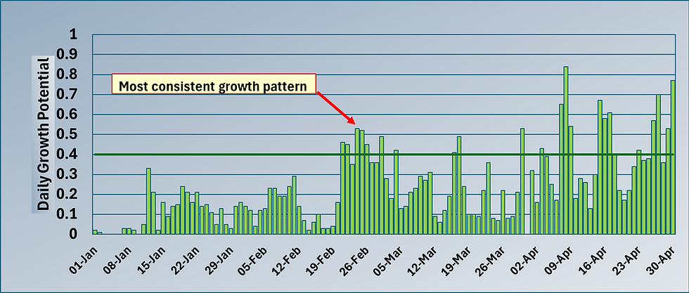
Turning now to plant stress levels, again I would put forward the case that we are over the worse in terms of sustained plant stress periods. For the same location I have charted out the daily E.T loss from the beginning of March this year and used a level of 4mm per day as the threshold for plant stress. Here is how it looks with individual plant stress days coloured in red.

So you can see the period from 14th June - 19th July represented the worst from a plant stress perspective peaking on the 12th of July with a daily E.T loss of 6.02mm. You can also see the respective heatwaves from the 8th - 12th of August and the end of last week as well, though lighter winds meant the latter wasn't as severe.
So again we are still in the thick of it from a plant stress perspective but I think we have got over the worst. Time will tell what will happen when we start to see significant periods of plant leaf wetness towards the end of the month and into September and how the sustained stress levels of the summer will dove-tail into enhanced Dollar Spot and Anthracnose disease levels. My hunch is that we will see significant pressure personally.
So that's how I see things, plenty to think about I guess for you managing your facility and also looking to the future. Fingers crossed for Erin making an appearance.
All the best.
Mark Hunt


Comments