
December 1st, 2025
- Mark Hunt

- Dec 1, 2025
- 7 min read
Hi All,
Today is the first day of meteorological winter, running from the 1st of December to the end of February. Outside the wind is howling and it is raining, but the temperature is in double figures. This is the 'new normal' kind of winter, mild, wet and windy.

Of late the daily newspapers have been proclaiming that the U.K is due to endure a major snow event with the occurrence of one of the earliest Sudden Stratospheric Warming (SSW) events we have noted at the end of November. SSW's are a complex meteorological process which can affect the position and strength of the jet stream leading to a higher likelihood of cold northerly or easterly air dominating our weather picture.
You can read about them here .
The media love them because as soon as they occur they dust off the old 'Beast from the east' headlines and give them a whirl. The plain facts are yes they can cause cold weather to dominate and no it doesn't happen every time we see a SSW event. In fact I'd say over the years the probability is weighted more against them having a cold temperature effect. That said when they do, we tend to know about it, the winter's of 2010 and 2013 spring to mind.
One to watch though because since mid-November we have had some genuine cold weather and I note from nature we have more Redwing and Fieldfares arriving daily. These Thrushes are from Scandinavia and Russia and tend to ship out when the weather is cold and the berry crop over there is decimated. As I fished a swollen (and chilly) River Trent last night I could hear these winter invaders heading over. I think they use the river as a navigation aid, picking it up at The Wash to head inland. I also saw a Barn Owl hunting just in front of me and an Otter at work. Lovely, I hope he had more luck locating fish than I did :).

If we do have a hard winter, it may bring with it an influx of those beautiful Waxwings that I just love seeing. They are arriving up north to feast on our berry crop and you never know, a run of easterlies just may bring over these beautiful birds.
Knowing we have seen a SSW event though does prime me to look further ahead on the ECMWF and GFS models just to see if there's a sniff of a change in the jet stream shape and strength which would suggest a potential knock on effect from this recent SSW.
And is there any sign of a weakening in the jet stream and a change in the weather pattern dynamics ?
As those projections sit now, yes, there is a sign of a weakening jet stream pattern and cold air building over Scandinavia and Eastern Europe around the 10th / 11th of December. Currently it doesn't look like affecting the U.K & Ireland (though Denmark looks pretty snowy and chilly to me) but it could set in place a run of easterlies, whether they'll be 'beastly easterlies' or not we will have to wait and see.
From a rainfall and drought recovery perspective, this run of weather would be unwelcome as it will mean a halt to our run of Atlantic low pressure systems and an end to consistent rainfall events. Later in the blog I will look at where I think we are in this process in one of our driest areas of the country, East Anglia. Here in The Midlands, our reservoir levels are on the way up but they have a huge way to go to give us water security looking ahead to 2026. At the end of October, Grafham and Rutland Water were only 63-64% full, that's a lot of water needing to be pumped in before we get to Spring 2026.


General Weather Situation
So SSW events aside, how do we sit at this present time weather-wise ?
Currently we are in a run of weather pushed along by a very strong jet stream. This means we are seeing Atlantic low pressure after Atlantic low pressure push in from the west and bring strong winds and rain. In-between we tend to have a cold temperature lull before the next low pressure system rocks up. Monday sees a continuation of this process as a big front of rain is pushed firstly across Ireland and then Wales and the south west of England before heading north and east to affect central and eastern regions. Winds will be very strong and south westerly veering southerly and it'll be milder than the weekend with temperature teetering on double figures. Later in the day, more rain pushes into western Ireland and the first rain front of the day will have already crossed The North Sea to bring rain to Denmark's western shores. Despite the fact that we have low pressure close by, Tuesday will see a hiatus with drier and sunnier weather for most, except the western coasts of Ireland and the U.K which will remain showery. Some of these showers may make it inland. Winds will be much lighter. This largely drier interlude will continue through to Wednesday, but later in the day we will see more rain usher into the west of Ireland and push across the country. Overnight into Thursday this rain will cross The Irish Sea into Wales and western coasts before moving inland through the course of the day. Denmark will be cooler with showers affecting mainly Jutland, the odd one venturing further east.
As we reach the end of the week, it'll be fresher with the wind tilting towards the south east, but this is just the calm before another deep Atlantic low pressure system presents itself off the west coast of Ireland on Friday morning with strengthening south westerly winds and rain pushing westerly across The Irish Sea into western-facing shores of the U.K before heading inland overnight into Saturday. The weekend then looks to be dominated by a sunshine and showers type theme, with strong winds and mild temperatures. Sunshine and showers for Denmark as well, the majority across the south and west before heavier rain arrives at the end of the weekend.
So a typical wet, wild and windy week in store, punctuated by some drier, less windy weather in-between.
Weather Outlook
Tricky one this because of the potential effect or non-effect of the SSW event. Currently it looks like we will start next week in pretty much the same vein we start this week. Mild, windy and potentially wet for the north and north western areas, possibly drier further south. This scenario carries through to mid-week / next week before we reach the point where we see a change in the shape and intensity of the jet stream around the 10th-11th of December. This is when we may see an end to the run of Atlantic low pressure systems and something more in the way of prolonged cold. It is a big 'may' because firstly it is a long way off and secondly, the odds usually stack against it, but you never know.
Agronomic Notes
So my topic for this week is to look at how far we have come to restore our water deficit across the south of England. I'd like to be able to look at multiple locations across the U.K, Ireland, etc but I don't have the time. Since we started getting appreciable rainfall back in September, some geographical areas of the U.K have seen significant recovery vs. other geographical areas. The rainfall has had the usual western bias, but also with southerly one as well, typical of the rainfall patterns we have seen of late. Some systems come in from the west, some come in from the south, so the south of England isn't the driest area typically I find, the east of England and The Midlands is. Certainly in 2025.
So I picked 4 locations, Worcester, Luton, Bury St Edmunds and Bristol, south western, western, central and eastern to have a look at where they stack up with respect to rainfall, E.T and soil moisture surplus / deficit (SMS/SMD).
Now this isn't an exact science because not all rain that falls stays in the soil, some sheds in flooding events and we are looking at evapotranspiration, that's the combination of water removal from the soil AND the grass plant. Evaporation is only part of this process and when we look at water reserves, we are looking at the balance between water input from rainfall and water loss through evaporation. There isn't an exact conversion from E.T to evaporation, so to keep a consistent comparison, in this exercise I have just compared rainfall vs. E.T and the subsequent balance between them on a monthly and cumulative basis. It gives an idea between different geographical locations how they shape up in this climatic dynamic.
Here are the 4 charts ;


So the above charts highlight quite well (I think) the difference geographically between the east, central, western and south western areas. Just to summarise the soil moisture surplus / deficit for the 4 locations ;
Bury St Edmunds -208.2mm-Soil moisture deficit
Luton -108.5mm -Soil moisture deficit
Worcester - 52.5mm -Soil moisture deficit
Bristol +238.5mm-Soil moisture surplus
So still a long way to go for East Anglia to return to a positive soil moisture surplus (> 8" in old money), also for central Midlands locations, but not to the same degree. The west of the country is faring better from a water recharge perspective and The South West, has significant excess. I know this is also similar for Wales as well, very, very wet. We will soon have the latest Met Office rainfall figures vs. the 1991-2020 anomaly and this will give us a more definitive measure of where the problem still exists from a geographical perspective.
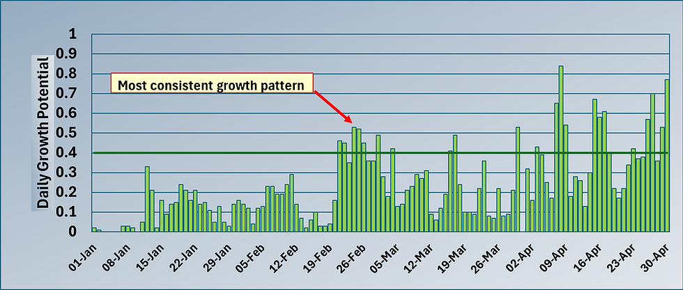
A month of two halves - growth-wise


Looking at the two graphs above, they provide a clear picture how the first half of November had a scenario of mild air temperature which provided both good growth for this time of year but also significant pressure from Microdochium. For some the growth was a blessing in providing recovery from wear and the high disease activity of October but only if they were protected from the disease pressure we also saw through the first half of November. Come the middle of the month, the air temperature dropped significantly and with it the disease pressure and growth as well, save for a brief flurry at the end of the month.
Now we are the run up to Christmas, the shortest day / Winter Solstice is little less than 3 weeks away and then we start the climb back towards spring and summer. Definitely a rare glass half full moment for me :)
All the best.
Mark Hunt


Comments