
November 17th, 2025
- Mark Hunt

- Nov 17, 2025
- 7 min read
Hi All,
As I watch the Grey Wagtails munching on some mealworms on the patio, these winter visitors to my garden are here because temperatures have now dropped to the point where insect life is more scarce and they need to supplement their diet. Wagtails are brilliantly adept at exploiting our modern day environment. When you're out Christmas shopping (zzzz), you'll see them in the shopping arcades snaffling up insects attracted to the heating and lights. I have also seen big flocks at Motorway service stations, picking insects out of the grills of cars and lorries. Nature adapts.
Last week I talked about low light levels and warm soil and air temperatures and how the two conspire to produce a grass plant that isn't growing in an optimum fashion. This suggests that one of our adaptations should / could be to extend the usage period of PGR's (Not for Denmark obviously) until we got to the point where Mother Nature applies her own PGR in the form of cold weather and consequently low daily Growth Potential.
Well this week Mother Nature is indeed applying a growth regulator as intimated last week, with cold northerly winds and a smattering of snow showers. It must be getting cold because The Daily Express is proclaiming the U.K will be blanketed by snow and a winter armageddon scenario. Ho hum. Hot on the heels of Storm Claudia depositing a months worth of rain in 24 hours.
Here in Market Harborough we are in an area known to flood. Made worse of course by the addition of lots of new houses built on flood plains and effectively funnelling all of the rainwater down hill into the centre of the town. At the end of November last year, people had to be evacuated from their properties by boat. We have a brilliant locally-led flood action group of which I am a part and last week we called on all of the local technology to try and ascertain if the threat of Storm Claudia would cause a repeat of last years issue.

Pulling in data from some local Davis weather stations I monitored the rain rate and rainfall volumes on a 15-minute basis. Although the media and the like focus on rainfall volumes, in my mind it is the rain rate that causes the issue. Just like on your surfaces.
In this case, the rain rate spent most of the time around 4-6mm per hr, which is classified as moderate rainfall, only uplifting to 24mm per hour right at the end of the rainfall event. The result was our drainage and river system was able to cope by and large (even though of course the local council hadn't kept the drains clear).
Storm Claudia gave us 63mm of rain with a rain rate peaking at 29.8mm per hour vs. our two previous flood events of 82.3mm / 286mm per hour and 54.1mm / 78.2mm per hour. My point is that it is the rain rate that causes the issues (and poor local planning / infrastructure of course) when it comes to flooding or probably more accurately the combination of rainfall and rain rate overwhelming drainage systems.
Interestingly I looked at the stats for Monmouth which has been hit hard by Storm Claudia and the rainfall amounts and rain rate are similar to what we experienced, but in Monmouth the local River Monnow broke its banks and overwhelmed flood defences. I think the difference in outcomes was primarily due to the fact that our local rivers were at summer levels prior to Storm Claudia but for The South West and Wales, they had received more rainfall prior to the storm. My thoughts are with everyone who has been affected by flooding.
That said, we need the rain in this central belt of The Midlands extending east to East Anglia, so every drop of that 63mm was welcome. I noted on Saturday that pumping from the rivers Nene and Welland had commenced into Rutland Water, so hopefully we will see levels start to recover, they have an awful long way to go. I am still of the opinion that we 'waste' a large part of these rainfall surplus events with insufficient storage in place where we need it and simply (in the case of The Fens) pump it out to sea.
Meteorologists are getting a bit excited by the possibility of a very early, sudden stratospheric warming event (see here for a Met Office explanation) taking place. These events can disrupt the flow of the jet stream and consequently pull very cold weather down from the north and east. It's a 'could' rather than a 'will' but it does point to the possibility that this winter may be colder than we have experienced of late. If I look to the skies, there's plenty of Fieldfares and Redwings coming over from Scandinavia and that often means harsher weather in the north and east. Fortunately a berry fest awaits them after the Mast Year.


Looking at the ECMWF projections for the next 10 days (shown above) we can indeed see a scenario mid-week when a northerly low pressure pushes down and drags a prevailing northerly wind with it, along with moisture. That combination will likely result in wintry showers across Scotland and the north / north east of England, with some of these extending further south to East Anglia and The Midlands. So for the first part of the week, we look pretty dry except for some rain and wintry showers across coastal areas of Scotland and Denmark. Much, much cooler than of late mind with air temperatures in the mid-single figures, a good 10°C cooler than a week ago, with that biting wind bringing a significant windchill. Come Tuesday, that mix of rain and wintry showers consolidates across Scotland and pushes south down the eastern side of the U.K. At the moment it doesn't look like it comes inland much, but that may change. Night time temperatures will drop to freezing so our first run of ground frosts of the winter this week. I think overnight Tuesday into Wednesday brings the greatest risk of snow / wintry showers and so I suggest keeping a good eye of your weather app and rain radar accordingly. That cold prevails through to the end of the week but with less risk of rain / wintry showers for the U.K & Ireland. Later on Friday the wind will swing round from the north west to the south west and that'll usher up the temperature a little for the weekend. Looking east to Denmark, Wednesday pm looks the wettest for you with a possibility of wintry showers across the east of Denmark through Thursday as your temperatures drop to low single figures by the end of the week. Some sleet showers maybe for the weekend.
Looking ahead we have a band of rain crossing Ireland from the west on Saturday pm which will bring rain to the west of the U.K and prior to that, the potential for some heavier rain Friday night into Saturday. By Sunday that wind is changing again, swinging round to the north west as a new, cold low pushes down across the U.K for the start of next week, bringing showers and heavier spells of rain on Tuesday, along with stronger winds. Next week looks cold, wet and windy for the first part of the week and then breaking down to the possibility of a more northerly airstream and wintry showers.
Winter has definitely arrived.
Agronomic Notes
After last week's discussion about extending the season for PGR usage to counteract the potential for growth elongation, I had a number of contacts that confirmed they are already doing this (Thanks James et al) and using the first frosts as a benchmark / line in the sand to finish applications.
Typically I think we see a significant drop in temperatures in the middle of November, it used to be the first week but it's on the move. That's the yardstick in my mind. I also see additional benefits in doing so because it'll theoretically extend early fungicide / plant hardener / dew control application longevity (less clip removed, less product removed) and promote a tighter sward habit. Concerns about delaying recovery should be negated because the growth habit should be more advantageous in terms of filling in early disease scarring (from mid-October's activity peak for instance). Something to think about for next year. In my mind I would start with a half rate application and assess the results from a clip yield perspective (if you are doing this), maybe higher in an outfield scenario.

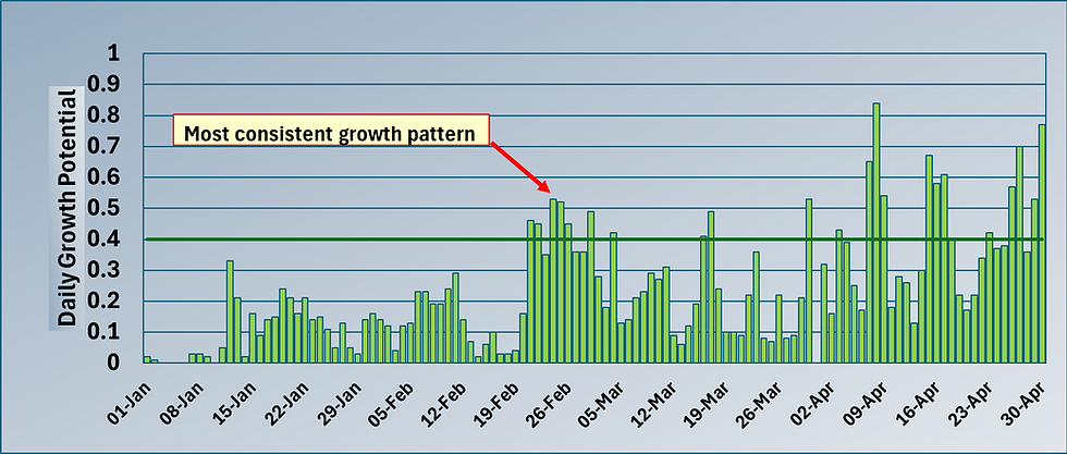
So, I thought I'd chart out the daily Growth Potential (G.P) for our default Thame, Oxfordshire location for the last 4 years including this one (adding the projected G.P for the rest of this month, which may of course change) just to see if my mid-November hunch was accurate ?
So hopefully you can see from the graph above that my hunch wasn't far off.
For this location, the daily G.P shows a significant dip from mid-November and it's been quite consistent over the last 4 years. Now I know in previous years, this drip would have normally occurred in early November, so it's moving as our climate warms. Now of course it doesn't stay down all winter, we do see peaks in the daily G.P, but they tend to be short-lived. Last year we had two mid-teen days on the 23rd and 24th November as an example, so the daily G.P spiked as we can see from the graph above, but it soon dropped down again. Other locations will of course be different but that's why monitoring your daily G.P is useful.
OK, that's me for another week. No blog next week as I am taking a trip to my Motherland to indulge the family and myself in all things Copenhagen, but mainly pastry-related in my case. I intend to run around most of Copenhagen's bakeries while I am over and get progressively fatter and more contented as I do so :)
Wrap up well, all the best.
Mark Hunt


Hi Mark, always enjoy your ventures into all things weather, linked to nature's rhythms and their impact on our agronomic tribulations. Thought you might emotional some info on Councils management of our flood infrastructure. The Wirral has, alledgedly, 60000 road gully pots, which used to be emptied a couple of times a year, but at least once. They now have only one clearance team, capable of only 30000 per year, flooding is happening at much lighter downpours than it used to. In their defence, I was told they were looking to employ a 2nd team.