
February 19th, 2024
- Mark Hunt

- Feb 19, 2024
- 9 min read
Hi All,
Yesterday I went out running, in a vain attempt to work on my winter-acquired lard, shorts on as it was a heady 13°C. The old railway line that connects Market Harborough to Northampton (Brampton Valley Way) was just one long stream punctuated by stretches of ankle deep water. It made the run 'entertaining' but as a head clearer, utterly essential to my congested mind. The day before, returning from a Rutland Water walk, I noticed the bright orange of some fields, treated with glyphosate ready to be ploughed in again and re-sown with spring wheat, barley, oats or Maize. In-between these fields was a patchwork of lush green and newly-ploughed fields. The countryside and farming is struggling and it'll have a knock on effect later this year and into next.
The play area in the park I run alongside was underwater yet again, that'll be 5 times this winter then vs. the usual once or twice and the local February rainfall total has just passed 100mm for the month and 165mm for the year. Last February, under the effects of a month-long blocking high, we notched a total of 6.6mm.
There in a nutshell is the difference between a peak and trough pattern in the jet stream and I expect February 2024 to sign off as pretty much our wettest ever. It has also been unseasonably mild with temperatures topping 18°C in the middle of February.
I'd love to be sitting here announcing a blocking high pressure coming into play but that isn't the case. As predicted last week, it looks like the end of February will see a return to winter as colder air pushes in later this week and we will have more rain / moisture this week and next. Sorry.
It isn't a great time for turfgrass management, it is hard work on heavy soils and push-up greens that have been saturated for months now. Not long till spring, longer days and better drying days hopefully, courtesy of higher E.T. I expect the taps to turn off in early March and everyone to be praying for rain by April !!!!!
General Weather Situation

The GIF's courtesy of tropicaltidbits.com tell a clear weather story with a jet stream dropping south and allowing cold air to flood in behind it by the end of the week. those shorts may be going back in the drawer for awhile I think !
So Monday sees rain across the north and east of the U.K clearing easterly to leave behind a largely dry day with some intervals of bright sunshine and a north westerly wind. The wind direction will drop the temperatures down from the heady heights of last week towards a more 'normal' 9-11°C. Whatever 'normal' is nowadays I muse.
Tuesday will see a rain front push diagonally (/) into Ireland and this will stretch from Kerry up the west coast, across The Irish Sea and into north west Scotland. As we go through the day, this front will sink south and east into Merseyside and North Wales by the afternoon and The Midlands by dusk. All the time it'll be weakening in intensity. So the south and east may stay dry all day. North and western areas will clear through the day as that rain front sinks away. The wind will be strong to gale force in places and will swing round to the south west maintaining similar temperatures to Monday.
Mid-week and overnight into Wednesday sees a heavy rain front push into the south west of Ireland and England. By dawn it'll be across most of Ireland and the western half of the U.K. Despite the strengthening wind, this front will be slow-moving and heavy rainfall totals will result in places I am afraid. By the morning rush hour, it will already be clearing the west of Ireland but will straddle the east of Ireland and all of the U.K. It will take until mid-afternoon to start clearing the western half of the U.K, with The South East, last on the list to clear. A feature of mid-week will be the strong south westerly wind and this will maintain temperatures in the 10-12°C range.
Thursday is the change day temperature-wise as that colder air begins to make its presence felt. A drier day for the west and north aside from showers across the west coast of Ireland and Scotland, but not for the south as that rain front will hang on across the southern half of England, from the Severn Estuary to The Wash, including the south Midlands. Here that rain will stay in situ for most of the day and not till dusk will it slip off eastwards, with some potentially heavy rain for East Anglia. The wind will be slightly less strong on Thursday and will swing round to the north west dropping the temperatures to 8-9°C.
Closing out the week on Friday and a drier day beckons after a colder start, again not totally dry with showers persisting on western coasts of the U.K and Ireland. Some of those showers will push inland during the second part of the day but shouldn't be too onerous in nature one would hope. Some sunny intervals as well and a strong to moderate westerly wind which should help to dry things out a little. Temperature-wise, 7-9°C, with the cooler temperatures across Scotland.
The outlook for the weekend is mixed, unsettled with showers but also some bright, sunny intervals. Saturday looks the wetter day with showers pushing in from western coasts inland through the day. Sunday looks drier up until Midday before showers will again push across Ireland and Wales / The Midlands during the 2nd part of the day. Brighter and sunny in the south but feeling cooler in that wind with 6-8°C reflecting more normal temperatures for this time of year.


Weather Outlook
So next week we see that colder air already firmly established across Europe.
Overnight into Monday, a deep depression is projected to be in place south of the U.K and this will pull in cold easterly / south easterly winds into the weather picture. There's a risk of snow / wintry showers I think being associated with this low pressure and the area at risk will be the south / east of England I think. As we progress into Tuesday that low sinks south and tilts the winds to the north east so that means colder and I think a threat of wintry showers across eastern coasts. Periods of night frost and lighter winds will punctuate the second half of next week with lighter northerly winds.
The colder air will clear towards the end of next week as milder air from the south west begins to push in as another deep Atlantic low pressure, with more rain is threatened for the weekend. If I Mystic Meg it, I can see high pressure establishing as we progress into the beginning of March w/c 4th March and this may provide a welcome break from the relentless run of wet weather we have endured 😊
Agronomic Notes
I have had a good response from end-users highlighting their early season aeration work, a lot of them seem to be in Kent for some reason, maybe they all drink in the same pub together 😊

Had a great set of pictures sent to me this week from a golf course in Kent, which I converted into the above collage. As you can see, it is an example of another 'early bird' aeration sequence, initially interrupted by some of the white stuff in mid-January. Undaunted they cracked on in late January and have seen great recovery courtesy of the mild spell of late. Thanks to Ben, Paul and Mark for the consistent 'Kent' feedback.
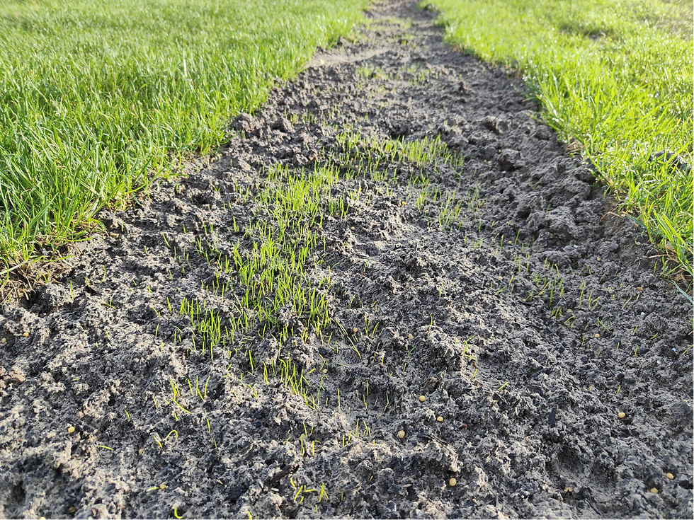
I even got sent a pic of seed germination in a newly-instated drain line seeded 2 weeks ago (cheers Ben). I am guessing that's Ryegrass emerging and I can also see some controlled release fertiliser in the picture as well, which is a good call on a free-draining rootzone. :)
That image got me wondering how the soil temperature has been 'behaving' since the start of the year, so I downloaded some data from one of our Davis weather stations, this time in Oxfordshire. You can clearly see the cold dip in mid-January. One of the phenomenon I often see when we have mild, wet weather in the winter is that the warmer air temperature confers to the rain and that increases the soil temperature really quickly. It hit 10.1°C yesterday !

Ok, so we are dropping colder again but that seed is away and ready for when temperature pick up again, that's got to be a bonus, hasn't it ?
So we have had the temperature for growth so far this year but then I wondered how light levels had fared from Jan 1st, 2024 ?
Now as I have said before we have a woeful lack of data as to what DLI level corresponds to a sufficiency level for Poa annua (reptans), Browntop Bent and the like, with only a figure of 11 mols per m2 per 24 hours for Perennial Ryegrass and 30 mols per m2 per 24 hours for Creeping Bentgrass. I suspect that the bentgrass figure isn't actually accurate for modern cultivars and that Poa annua reptans is happy enough growing with 8-10 mols per m2 per 24 hours.

So you could look at this graph and say, yep we have sufficient levels for Perennial Ryegrass on some days and Poa annua on a good few more. The club above that submitted their renovation images also reported late last week that their clipping yield hit 1.4 litres per m2 cutting at 5mm on a Poa / Bent sward. This type of clipping yield is more pertinent to a late spring / summer time of year than to mid-February.
So that means we have a grass plant or grass plants collectively growing in Mid-February at the same rate as you'd expect in the true growing season (whenever that is) despite the fact that day length is shorter and daily light levels are a good 60% lower than what we would expect to see later in the spring and into the summer.
Temperature-wise from a growth potential perspective, this site varied from 0.33 - 0.60 last week, high for the time of year but a long way from optimum I am sure you'd agree.
Something doesn't add up to me, after all, isn't light the driving force behind plant growth via the photosynthetic process ?
Or is something else playing a bigger part in growth that we aren't making an allowance for in growth models and light sufficiency levels ?
Organic matter - that 'ol Cheshnut
I have been reading Micah Woods excellent articles on the above subject and like many, it has made me think. (Click here to go straight to his blog posts)
Not so much on the way we tackle organic matter removal as Micah has covered but the way the grass plant is growing in our modern-day climate. This year already I am hearing a number of clubs that have had historical organic matter measurements undertaken (using the same method year-on-year sampling and analysis) and they have reported increases in organic matter. Now it's early days in this respect to say it's a general trend but hopefully later this month I'll feature some year-on-year comparisons to highlight this. These are clubs that have aerated and top dressed, some diluting, some removing, some a combination, but the trend with respect to organic matter production is provisionally upward. So the question in my mind is why ?
Is it straight-forward case that last year in 2023, we had more growth because of the wetter, cooler summer and less high temperature stress events?
Is it because we had more 'natural growth' from the conversion of organic nitrogen to mineral nitrogen due to climatic variation ?
Is it because we had less microbial decomposition of organic matter across the year due to climatic variation ?
Or maybe a combination of the above ?
I don't have the answer but I believe it is pertinent to the process of organic matter management. After all how do we decide how much organic matter we need to remove or dilute, where is the sweet spot in terms of playability and plant health at your facility and how do you justify / communicate this to management ?
One last point on looking at data from overseas and applying it to your situation in Ireland, England, Wales or Scotland. (This isn't a negative about overseas research because god knows we would be lost without it sometimes)
We have a unique climate. One for example that I have demonstrated in this week's blog can provide consistent grass plant growth at a time of year when in other climates their plant is completely dormant sitting under snow and ice cover (due to harder, colder winters and / or their grass species). You can't just transplant data from a dormant season climate to your scenario in the U.K & Ireland without taking into account the differences that climate engenders on grass growth.
Food for thought maybe ?.........T'is for me....
All the best.
Mark Hunt


Thank you Mark,
Another excellent blog.
Regards
Chris